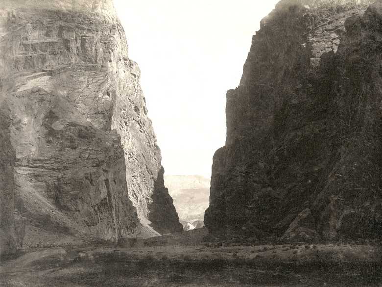
ABC 145 — Bajgah Gorge
View into a narrow gorge. The cragged cliffs on both sides are very steep. The gorge is blocked by a stone wall. In front of it a building may be recognized. In the background a hilly landscape becomes visible.
[List:] 145. Dara Bajgah from the village, looking north.
- Foucher, A. (1942): La vieille route de l’Inde de Bactres à Taxila, Vol. 2, pl. 4: similar view of the same gorge, taken in 1924.
- Adamec , L.W. (1979): Mazar-i-Sharif and north-central Afghanistan, pp. 94-96: Bajgah; p. 95: “‘The road to the Kara Kotal now turns left (north) through the gorge. The latter is 60 to 80 yards wide, with a smooth gravelly floor. A small, shallow stream comes winding through it, and is crossed by the road which is good and level. The rocks on either side are great height, perpendicular, and absolutely inaccessible. A breastwork thrown across the defile during the British occupation still exists.’ […]”
Image No
ABC 145
Collection
Afghan Boundary Commission 1884-86
Série
ABC 3, Photographs 117 to 167
Format
Sepia print, 146/198 mm
Qualité
good, darkened, right margin faded, some spots
Lieu, date
Bajgah Gorge, end of October, 1885
Descripteurs
Latitude / Longitude35.349439 / 67.802164
Google Earth35°21ʹ N / 67°52ʹ E
Google Mapshttps://maps.google.com
Zoom Earthhttps://zoom.earth
Survey of India MapSheet 33, Kalat-i-Ghilazai (1916): Bajgah, not mentioned, 1 D
Vous en savez plus sur cette photo?


