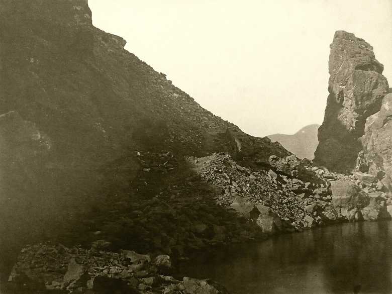
RE 009 — Rock Defile on the Road to Jalalabad
Another view of the same difficult passage on the road along the Kabul River at Girdi Kats, about 15 km E of Jalalabad.
[Album Chatham:] Rock Defile on the road to Jellalabad.
[S&M List:] 1-31 Rock near Dakka on the Jellalabad Road.
- Original:
Chatham: Box No.: E 5, Album No.: 6/6, Page No.: 16 - The Second Afghan War 1878-80: Abridged Official Account (1908), f.p. 64: map of the region East of Jalalabad.
- Professional Papers of the Corps of Royal Engineers, Vol. 4 (1880), Occasional Paper 8, p. 88 and Occasional Paper 11, pp. 133-134: Description of the road construction.
- E.T. Thackeray (1881) Views of Kabul and Environs, p. 57 refers to the construction of this road.
- Adamec (1985): Kabul and southeastern Afghanistan, p. 232: Girdi Kats or Kach.
Image No.
RE 009
Collection
Royal Engineers Museum, Library and Archive 1878-1880 1878-1880
Series
RE 001-056, Khyber, Jalalabad, Gandamak
Format
Albumen paper with gold toning, 210/280 mm, mounted on cardboard
Quality
very dark in the shadow, faded
Place, date
Girdi Kats, Feb./March 1879
Descriptors
Latitude / Longitude34.397356 / 70.653933
Google Earthapprox. 34°24' N / 70°39' E / 520 m
Google Mapshttps://maps.google.com
Zoom Earthhttps://zoom.earth
Survey of India MapSheet 38, Kabul (1917): Girdi Kats, 2C 64
You know more about this picture?


