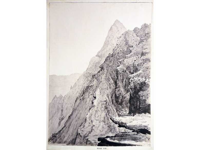
ELD 028 — Doshakh Peak
Sepia-toned photo-lithograph of a wash sketch, showing the steep cliffs on the northern side of the Doshakh Peak, looking east.
[Sketch, recto:] DOSHAKH / E.D. / 85. // Photographed by the Survey of India Department. // DOSHAK GIRD.
[Sketch, verso:] (24) / Doshakh peak / Herat valley.
[Lumsden Album:] –
[List:] (27) Doshakh, another view of the same peak on its northern face where it falls sheer some thousands of feet towards the Herat Valley.
- Griesbach, C. L. (1885): Afghan Field Notes, p. 61: “The range which runs more or less with the 34° North latitude, and which on our maps bears the names of the Siah Koh and Doshakh mountains, marks a complete change in the geological structure of Central Asia. Whereas south of this range no older rocks than of the cretaceous period are known to exist, the Doshakh range itself consists of palaeozoic rocks. […]”
- Stewart, C.E. (1886): The Herat valley and the Persian Border, p. 154: description of the vegetation around Doshakh Peak.
- Yate, A.C. (1887): Travels with the Afghan Boundary Commission, p. 133: “[…] In the distance to the north or north-west [from Aukal] stood up the Du-shakh range, so called from a double peak near its centre. […]”; p. 134: “[…] I obtained, however, an excellent view of the whole valley west of the city [of Herat], to a point where an outlying spur of the Du-shakh range (called Kuh-i-kuftar Khan), running from south-west to north-east, abuts on the Hari Rud, and severs the Herat valley proper from the valley of Ghorian and Kuhsan. South and east I looked over the broad undulating plain traversed by several low ranges of hills, the scene of our 38-mile march, on the 11th, from Sher Bakhsh to Chah Gazak. Eastwards the double peak of the Kuh-i-du-shakh (the two-horn range) appeared us but one; whereas from the south at Sher Bakhsh, or from the north at Zindajan and Rauzanak, the two peaks are distinctly visible. […]”
- Yate, C.E. (1888): Northern Afghanistan or Letters from the Afghan Boundary Commission, p. 19: “[…] On the 30th [July 1885], with the cavalry escort, and accompanied by Captain Peacocke, Mr Merk, Captain Griesbach, Dr Owen, and myself, he [Ridgeway] marched northwards again, while the Heavy camp and the Infantry Escort at the same time moved westwards to a more elevated site in the Doshakh range, conveniently situated in case of any emergency. […]”; p. 23: “[…] The Heavy camp and Infantry Escort are still encamped in the midst of the Doshakh range, where they enjoy a climate much more free from wind than we get here down in the Herat valley. […]”
- Adamec, L.W. (1975): Herat and north-western Afghanistan, p. 101: Doshakh.
Bild Nr.
ELD 028
Sammlung
Afghan Boundary Commission 1884-86
Serie
ABC 4, ELD Sketches 001 to 053
Format
Original wash sketch, British Library WD 433, size 530/370 mm Lithograph in the Lumsden Album 397/280 mm (75% of original size)
Ort, Datum
Doshakh, August, 1885
Deskriptoren
Breitengrad / Längengrad34.072887 / 61.564582
Google Earth34°04ʹ22ʺ N / 61°33ʹ38ʺ E / 1900 m
Google Mapshttps://maps.google.com
Zoom Earthhttps://zoom.earth
Survey of India MapSheet 29, Herat (1916): Doshakh (peak), O 51
Sie wissen mehr zu diesem Bild?


