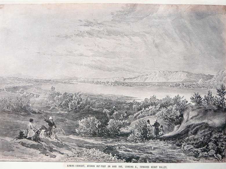
ELD 046 — Kaman-e Bihisht on the Hari Rud River
Sepia-toned photo-lithograph of a wash sketch, showing a chase scene at the banks of the Hari Rud River. On the left two Afghan horsemen are galloping, one is holding a whip in his hand. In the middle the man sitting on the ground, the horseman beside him is pointing at him. On the right side three people standing around a smoking fire.
Sepia-toned photo-lithograph of a wash sketch, showing a chase scene at the banks of the Hari Rud River. On the left two Afghan horsemen are galloping, one is holding a whip in his hand. In the middle the man sitting on the ground, the horseman beside him is pointing at him. On the right side three people standing around a smoking fire.
[Sketch, recto:] E.D. / 85. // Photographed by the Survey of India Department. // KAMAN-I-BIHISHT, AFGHAN OUT-POST ON HARI RUD, LOOKING S., TOWARDS HERAT VALLEY.
[Sketch, verso:] (44) / Kaman-i-Behisht (means the Heavenly Bow) Afghan outpost on Hari Rud looking South towards Herat Valley / May 85.
[Lumsden Album:] –
[List:] (45) Kaman Bihisht, same going North from Herat.
- Peacocke, W (1887): Records of Intelligence Party ABC, Vol. 3, p. 64 (Nov. 27, 1884): description of first visit to Kaman-e Bihisht on 27 and 28 November 1884.
- Yate, A.C. (1887): Travels with the Afghan Boundary Commission, p. 162: Kaman-i-Bihisht is mentioned.
- The Graphic, Vol. 64 (1901/2), October 26, p. 544: engraving based on this photo-lithograph, “Kaman-i-Bihisht, an Afghan outpost on the Hari Rud, looking south towards the Herat Valley.”
- Adamec, L.W. (1975): Herat and north-western Afghanistan, p. 245: Kaman-i-Bihisht, “Elevation 1,800 feet. […] In 1884 there was no sign of any cultivation, though the remains of an old canal near Kala Khalsang, and of some irrigation channels at Kaman-i-Bihisht, indicate that portions of the fertile bed of the rud were formerly cultivated. The river in November 1884 was 20 to 75 yards wide, 1 foot deep; gravel bottom; low banks. (Peacocke.)”
Bild Nr.
ELD 046
Sammlung
Afghan Boundary Commission 1884-86
Serie
ABC 4, ELD Sketches 001 to 053
Format
Original wash sketch, British Library WD 420, size 320/470 mm Lithograph in the Lumsden Album 286/421 mm (89 % of original size)
Ort, Datum
Kaman-e Bihisht, May 15, 1885
Deskriptoren
Breitengrad / Längengrad35.300143 / 61.192293
Google Earth35°02ʹ N / 61°07ʹ E / 680 m
Google Mapshttps://maps.google.com
Zoom Earthhttps://zoom.earth
Survey of India MapSheet 29, Herat (1916): Kaman-i-Bihisht, J 13
Sie wissen mehr zu diesem Bild?


