ABC 001 — Ziyarat Shah Ismail
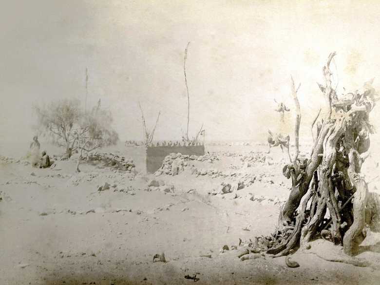
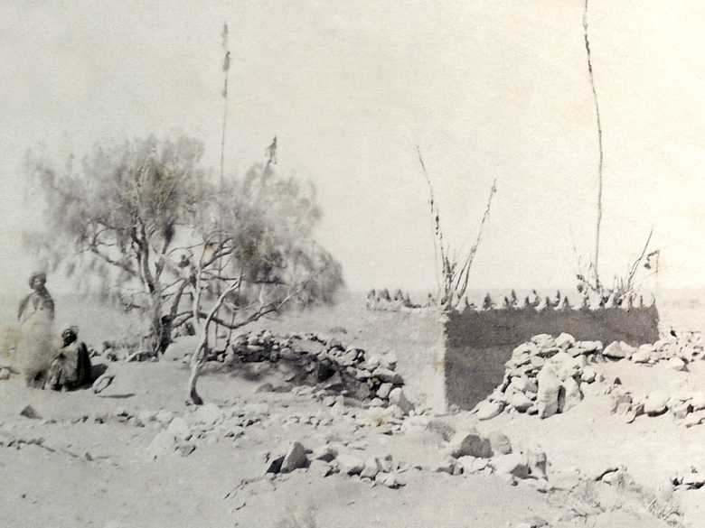
A holy grave and place of pilgrimage on the northern slope of the Chagai Hills, about 210 km west of Nushki. The low mud wall is adorned with a triangular crenellation. Within the wall several poles decorated with shreds of material deposed by pilgrims praying for the fulfilment of a desire. A dilapidated wall made of loose stones encircles the mud wall. In the right foreground a bundle of twisted poles, decorated with dozens of ram horns which are a usual decoration for ziyarats everywhere in A...
A holy grave and place of pilgrimage on the northern slope of the Chagai Hills, about 210 km west of Nushki. The low mud wall is adorned with a triangular crenellation. Within the wall several poles decorated with shreds of material deposed by pilgrims praying for the fulfilment of a desire. A dilapidated wall made of loose stones encircles the mud wall. In the right foreground a bundle of twisted poles, decorated with dozens of ram horns which are a usual decoration for ziyarats everywhere in Afghanistan. In the background some white tents of the ABC. On the left side of the ziyarat, under a tamarisk tree, two men in traditional dress.
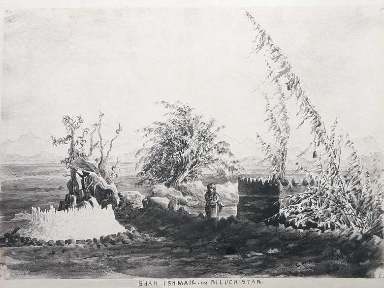
[List:] 1. Shah Ismail Ziarat, Biluchistán desert.
- Collection Edward L. Durand, sketch ELD 008: same place.
- Owen, Charles (1884-86): Transcript of diary and letters, p. 91: “8 Oct. [1884] Camp Shah Ismail. We marched at 4 pm yesterday for this camp which we reached about midnight.”; p. 92: “9 Oct. [1884] […] Shah Ismail is so named from a tomb in which Shah Ismail was buried. He apparently married the grand-daughter of Mahommed. The popular legend is that since he came here water appeared; at no other place near at hand is water found. […] There is a tomb of a Beloochi sirdar here which is covered with stones of Chagorlite, which looks exactly like jade; it is found in large quantities at Galachah.”; pp. 93-94: “14 Oct. [1884] […] Owing to the intense dryness of the atmosphere there is a general complaint in camp that clothes and boots have shrunk so as not to be wearable. […]”
- Holdich, T.H. (1885): Afghan Boundary Commission; Geographical Notes, p. 42: “At Shah Ismail, half-way between Nushki and the Helmund, is a ziarat of some distinction. An eminent saint who has left his name to the place where he was buried, died here about the time of Nadir Shah, and round about his grave are now collected many other graves of good Mahommedans, who have been carried here to be buried. The saintly tomb is enclosed within a mud-built crenellated wall, overshadowed by two stunted specimens of tamarisk, and adorned with the usual bundles of poles and sticks set up close by with gay streamers and coloured rags fluttering from them in the desert breeze. At the ends of some of the longer pennants or streamers are small bells attached, the musical tinkling of which is carried far across the uninterrupted waste around.”
- Weir, T.S. (1893): From India to the Caspian, pp. 17-18: “[…] Each grave was ornamented, had an armour, so to speak, of alabaster and stones of various tints. At the head of some of the graves, pieces of the whitest marble were placed, and these pieces were arranged to indicate a pillar rising some feet higher than the arched surface of the graves. To the pillars and to the stones at the ends of the graves white bands of cloth were attached. These bands of cloth – and this is the most curious feature – were twisted in the middle, and in the knot of the twist little black stones were placed. […]”
- Tate, G.P. (1910): Seistan, a memoir on the history, topography, ruins, and people of the country, p. 206: “The roadway over the bridge [Takht-i-Pul bridge] bears 329 degrees, or 31 degrees west of north. In this direction there are a group of mounds, evidently of old buildings, around the Ziarat of Shah Ismail about 3 miles beyond the bridge.”
- Adamec, L.W. (1973): Farah and south-western Afghanistan, p. 303: Ziarat-i-Shah Ismail.
Image No
ABC 001
Collection
Afghan Boundary Commission 1884-86
Série
ABC 1, Photographs 001 to 057
Format
Sepia print, 134/198 mm
Qualité
severely faded, mouldy spots
Lieu, date
Ziyarat-e Shah Ismail, October 9, 1884
Descripteurs
Latitude / Longitude29.678189 / 64.277122
Google Earth29°40ʹ42ʺ N / 64°16ʹ34ʺ E / 1220 m
Google Mapshttps://maps.google.com
Zoom Earthhttps://zoom.earth
Survey of India MapSheet 34, Quetta (1922): Shah Ismail, R 27
Vous en savez plus sur cette photo?


