ABC 002 — Helmand near Rudbar
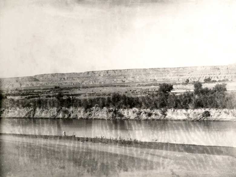
General view from the southern bank of the meandering Hilmand River, north of Rudbar, to its terraced steep cliff in the background. Some horses and camels are grazing on the opposite bank of the river.
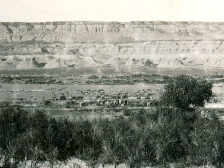
Enlargement, showing ABC officers on the opposite bank of the river, and hillocks in the background.
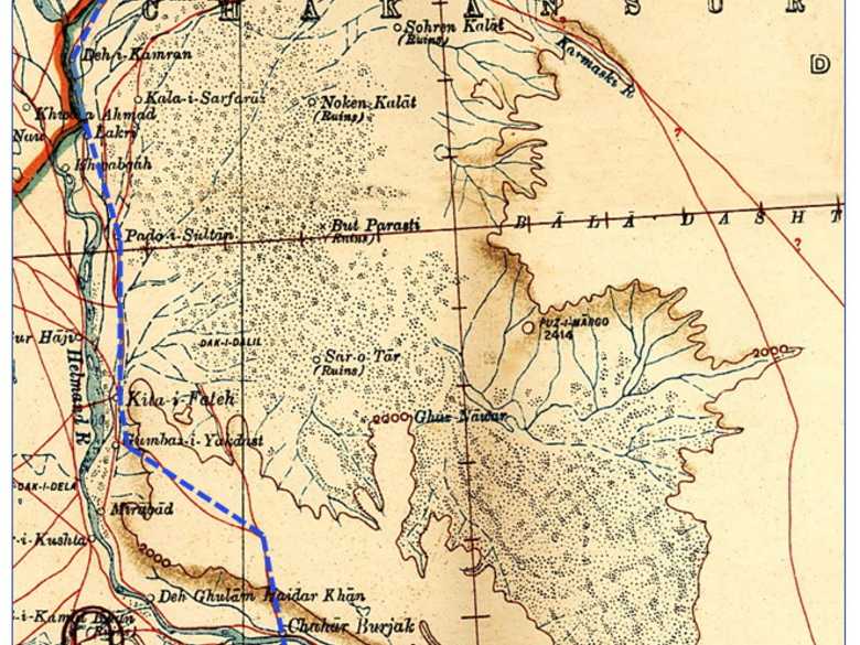
Survey of India Map: Sheet 30, Sistan (1918): showing the itinerary from October 21 to 30, 1884: Rudbar, P33 – Kilah-i-Fateh, O 58 – Ibrahimabad, J 65.
General view from the southern bank of the meandering Hilmand River, north of Rudbar, to its terraced steep cliff in the background. Some horses and camels are grazing on the opposite bank of the river.
[List:] 2. Helmund near Rudbár.
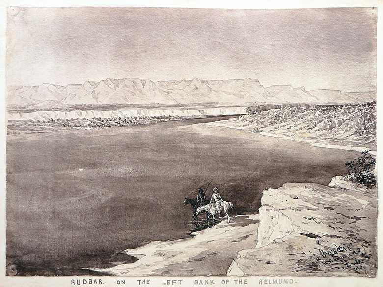
- Collection Edward L. Durand, sketch ELD 011: same place.
- Owen, Charles (1884-86): Transcript of diary and letters, p. 96: “20 Oct. [1884] We marched at 5.30 am for Rudbar, the chief city of Afghan Seistan. It is situated on the Helmund just were the river makes its bend into Seistan. […]”
- Holdich, T.H. (1885): Afghan Boundary Commission; Geographical Notes, p. 161: description of the Helmand basin near Rudbar.
- Peacocke, W (1887): Records of Intelligence Party ABC, Vol. 3, p. 16 (Oct. 20, 1884): “At 12½ miles Rudbar, consisting of three villages, viz., that of Azim Khan, of Muhammad Mirza Khan, and the cluster of buildings and walled gardens surrounding the old fort of Rudbar, which contain respectively 60, 200, and 150 males. (Total population probably 2,000). […]”
- Maitland, P.J. (1888): Records of Intelligence Party ABC, Vol. 1, p. 58 (Oct. 20, 1884): “The river at Rudbar is really a fine stream. Its breadth now is as nearly as possible 200 yards, and its depth 5 or 6 feet with a current of about 1 ½ miles an hour. There is a ford nearly opposite Imam Khan’s fort (that is, the west one). The water in the deepest part is said to be 3 feet, or 3 feet 6 inches, with a good bottom. […]”
- Yate, C.E. (1888): Northern Afghanistan or Letters from the Afghan Boundary Commission, p. 83: concerning the march back to India, “[…] The Helmand very possibly may be found at its usual level and easily fordable; but still there is always the chance of a winter flood, and it has been thought best to avoid the risk of a detention on the banks of the river in a place where it might not be easy to find further supplies at hand.”
- Tate, G.P. (1910): Seistan, a memoir on the history, topography, ruins and people of the country, p. 127: “At Rudbar (on the Helmand) the trough of the river is 320 feet above the floor of the Gaud-i-Zireh to the south of the district. The springs at Urak on the banks above the floor of the great depression are probably due to leakage form the Helmand allowed by a softer stratum.”
- Adamec, L.W. (1973): Farah and south-western Afghanistan, p. 247: Rudbar; p. 249: “The river at Rudbar is really a fine stream. Its breadth now is as nearly as possible 200 yards, and its depth 5 or 6 feet with a current of about 1 ½ miles an hour. There is a ford nearly opposite Imam Khan’s fort (that is, the west one). The water in the deepest part is said to be 3 feet, or 3 feet 6 inches, with a good bottom. […]”
Image No
ABC 002
Collection
Afghan Boundary Commission 1884-86
Série
ABC 1, Photographs 001 to 057
Format
Sepia print, 147/198 mm
Qualité
good, marbled pattern in the lower part of the photograph
Lieu, date
Rudbar, October 21, 1884
Descripteurs
Latitude / Longitude30.156875 / 62.539207
Google Earth30°09ʹ20ʺ N / 62°34ʹ28ʺ E / 550 m
Google Mapshttps://maps.google.com
Zoom Earthhttps://zoom.earth
Survey of India MapSheet 30, Sistan (1918): Rudbar, P 33
Vous en savez plus sur cette photo?


