ABC 130/131/132 — Maimana City
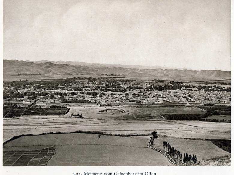
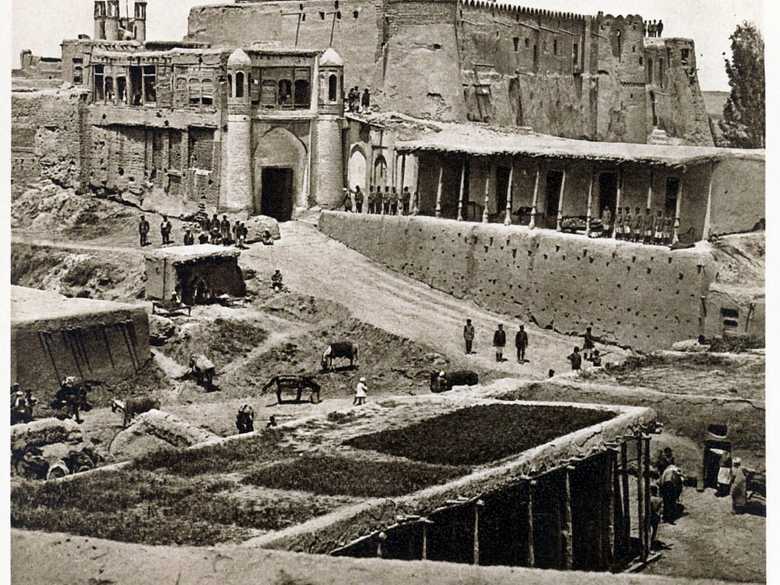
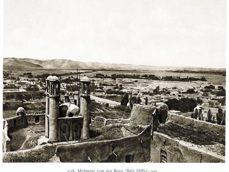
Probably some photographs of Maimana, similar to the ones published by Oskar Niedermayer.
[List:] 130. Maimana city.
[List:] 131. Maimana city
[List:] 132. Maimana city.
[List:] 131. Maimana city
[List:] 132. Maimana city.
- Grodekov, N.; Marvin, Ch. (1880): Colonel Grodekoff’s Ride from Samarcand to Herat: Through Balkh and the Usbek States of Afghan Turkestan, pp. 110-112: description of Maimana and its history.
- Lansdell, H. (1887): Through Central Asia, p. 629: “Owing to rainy weather the English Commissioner and political officers did not leave Chahar-Shambeh until the 7th of May [1886], two days after which they arrived near Maimana. Here again, the weather was very unsettled, and floods prevailed, with loss of lift to the natives, one entire village of thirty families being destroyed near the British Commissioner’s camp.”
- Yate, A.C. (1887): Travels with the Afghan Boundary Commission, p. 262: short description of Maimena.
- Parliamentary Blue Papers (1888): Sketch Map: Maimana, approx: 35°55ʹ N / 64°45ʹ E.
- Niedermayer, O. (1924): Afganistan, pl. 234-236: Maimana.
- Adamec, L.W. (1979): Mazar-i-Sharif and north-central Afghanistan, pp. 397-405: Maimana.
- Ball, W. (1981): Archaeological Gazetteer of Afghanistan, pp. 178-179: Maimana; p. 511: map.
Image No.
ABC 130/131/132
Collection
Afghan Boundary Commission 1884-86
Series
ABC 3, Photographs 117 to 167
Format
Sepia print
Place, date
Maimana, Spring, 1886
Descriptors
Latitude / Longitude35.921050 / 64.782870
Google Earth35°55ʹ N / 64°47ʹ E
Google Mapshttps://maps.google.com
Zoom Earthhttps://zoom.earth
Survey of India MapSheet 33, Kalat-i-Ghilazai (1916): Maimana, 1 A
You know more about this picture?


