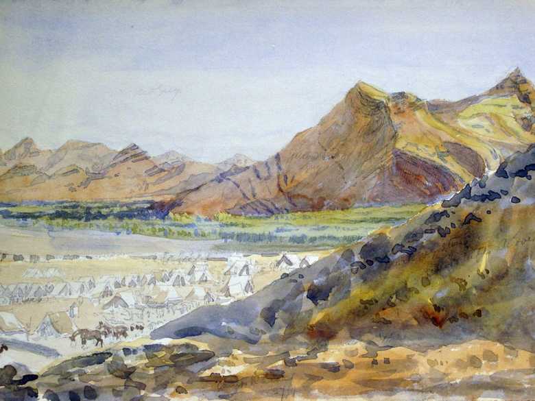
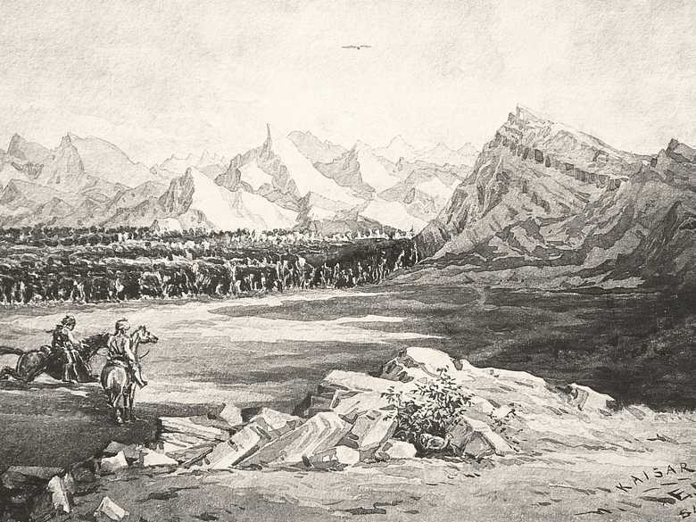
ELD 109 — ABC Camp in the Khaisar Valley
Unfinished watercolour sketch, taken near the place, where ELD 001 was sketched, showing the British camp near the tamarisk (khaisar) jungle.
Unlike ELD 001-107 this sketch was not photo-lithographed
Unlike ELD 001-107 this sketch was not photo-lithographed
[Sketch, recto:] Camp Kaisar, 27/9.
- Owen, Charles (1884-86): Transcript of diary and letters, p. 86: “27 Sep. [1884] The heavy baggage left camp Chaman at 6 pm [Sep. 26, 1884] for Khaiser. […] For 24 miles there is not a scrap of water but here it is plentiful and good. There is a good deal of low scrub making splendid camel grazing. […]”; p. 87: “28 Sep. [1884] Marched at 3.30 am for Nushki a distance of 15 miles. Road or track stony, runs mostly along bed of river Khaiser between high cliffs. Bed full of tamarisk trees. […]”
- Holdich, T.H. (1885): Afghan Boundary Commission; Geographical Notes, p. 40: “[…] From Singbur Chaman to Kaisar was a trying march of 25 miles over ground always rough and stony, and occasionally steep and difficult for laden camels, where the narrow path crossed an occasional watershed. This march was accomplished at night, and it speaks well for the efficiency of the transport (locally raised), and the fitness of the escort, that there were no sore backs and no failing out for hospital treatment at the end of it. The climate is specially trying at this time of the year; the intense heat of the sun by day is unpleasantly balanced by bitter cold nights, the extreme range of temperature in the course of twenty-four hours being quite abnormal. […] Kaisar, though only a halting-place, was a charming change in the weary scene of desolation afforded by the monotony of dust-coloured sandstone hills overlooking dust-covered sandy plains. The Kaisar stream has formed a wide channel for itself, filled in with a jungle of tamarisk (occasionally mixed with a species of clematis) which fringes the banks, and marks the progress of the river with a really good solid-looking growth of vegetation. […]”
- Peacocke, W. (1887): Records of Intelligence Party ABC, Vol. 3, p. 2 (Sept. 16, 1884): “Kaisar. – A large pond in an almosrt dry watercourse […].”
- Yate, A.C. (1887): Travels with the Afghan Boundary Commission, p. 33: “[…] Khaisar, as I was informed by a Beluch sowar, is the Beluchi word for tamarisk. The river is termed Khaisar Lora, because its bed (as far as the eye could see) is a dense mass of tamarisk. […]”; p. 42: “[…] I have noticed that the water of streams flowing in channels where the tamarisk grows is invariably full of vegetable matter, and speedily becomes putrid when drawn from the stream. […]”
- Holdich, T. H. (1901): The Indian Borderland, p. 103: “[…] Between Quetta and Nushki, which lies seventy miles to the south-west as the crow flies, we wandered amongst the mountains. There is nothing approaching desert in this part of Kalat. The hills tower in rough and fantastic forms on either side of the narrow valleys along which the route to Nushki mountain scenery open out in monotonous succession. […] The valleys are sometimes quite pretty. The grass is coarse and grows in tufts, but it grows freely. The tamarisk trees are graceful, though never remarkable for intensity of colour save in the short season when they blossom into tufted heads of russet and purple-red. Even then it takes the level rays of a dropping sun to warm them from their aesthetic tendency to undecided tones into the bright vividness of wholesome vegetation. […]”
- Moran, Neil K. (2005): Kipling and Afghanistan, p. 13: “[…] Quetta on the border of Afghanistan was chosen as the assembling point for the Indian military escort under command of Major Ridgeway. From Quetta the convoy had to make its way ’across 400 miles of untraversed wilderness, commencing with the arid flats of Baluchistan lying south of the Helmund (much of which is absolute desert), concluding with the wide rolling scrub-covered dasht, which stretch all the way from the Helmund river to Herat along the Perso-Afghan border’. […]”; pp. 17-18: “[…] Colonel Ridgeway accompanied by Captain Yate arrived in Quetta on the second of September and gradually troops and participants filtered in. On September 3, 244 riffles of the 20th Panjab under Lieutenant Meiklejohn and five native officers checked in as well as Captain Gore of the survey. The mission required 1,600 camels, of which 1,100 were then there with 200 more on the way, whence another 300 extra camels had to be procured. On September 5, 64 sabres of the 11th Bengal Lancers under Lieutenant Wright arrived, with another 100 under Colonel Prinsep expected the next day. The logistical staff calculated that the mission would comprise of not less than 1,600 people and 600 horses and mules. By September 14, there were 300 sabres of the 11th Bengal Lancers and 240 bayonets of the 20th Panjab Infantry in the camp. On September 12 Edward Durand sent his first ABC newsletter from Quetta. The arrangement with the Gazette seems to have been that Durand would cover the first part of the campaign from Quetta to Herat, but on reaching the border to Turkestan, Owen would take over the duties as Gazette correspondent. […]”
Image No.
ELD 109
Collection
Afghan Boundary Commission 1884-86
Series
ABC 6, ELD Sketches 108 to 134
Format
Watercolour, British Library WD 377, size 255/355 mm
Place, date
Khaisar near Galangur, September 27, 1884
Descriptors
Latitude / Longitude29.576631 / 66.125907
Google Earthapprox. 29°34'36"N / 66°07'33"E / 1370 m
Google Mapshttps://maps.google.com
Zoom Earthhttps://zoom.earth
Survey of India MapSheet 34, Quetta (1922): Galangur, T 15
You know more about this picture?


