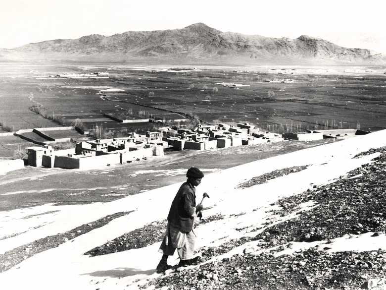
AEE 083 — Die Ebene von / The plain of khwaja rawash
|AEE 083| Blick vom bibi mahru-Hügel nach Nordosten auf die Ebene und Berge von khwaja rawash. In dieser Ebene liegt seit 1963 der internationale Flughafen von Kabul. ♦♦♦ View to the north from bibi mahru hill towards khwaja rawash. Since 1963 lies Kabul International Airport in the middle of this plain.
|AEE 083|
Blick vom bibi mahru-Hügel nach Nordosten auf die Ebene und Berge von khwaja rawash. In dieser Ebene liegt seit 1963 der internationale Flughafen von Kabul.
♦♦♦
View to the north from bibi mahru hill towards khwaja rawash. Since 1963 lies Kabul International Airport in the middle of this plain.
[Liste der Negative:] 12-045 – Dorf hinter Sherpur. Ueber den Höhenzug im Hintergrund führt der östliche Weg nach Charikar.
- M. Schinasi (2017): Kabul – a history 1773-1948, p. 106: “Chaman-e Nezami, the usual place for Afghan army maneuvers, was located beyond Bimahru near the village of Khwaja Rawash at the foot of the Deh Sabz mountain range about seven kilometers on a direct line from Nagharakhana [Pashtunistan Place].”
Image No.
AEE 083
Collection
Albert E. Engler 1939-1944
Series
AEE 082-097, Umgebung von Kabul, Paghman
Format
Negativ, Film 81/111 mm; Neuer Abzug 180/247 mm
Quality
gut
Place, date
Kabul, 1939-1944
Descriptors
Latitude / Longitude34.545180 / 69.193890
Google Earthca. 34°32'42.7"N / 69°11'38.0"E / 1'850 m
Google Mapshttps://maps.google.com
Zoom Earthhttps://zoom.earth
You know more about this picture?


