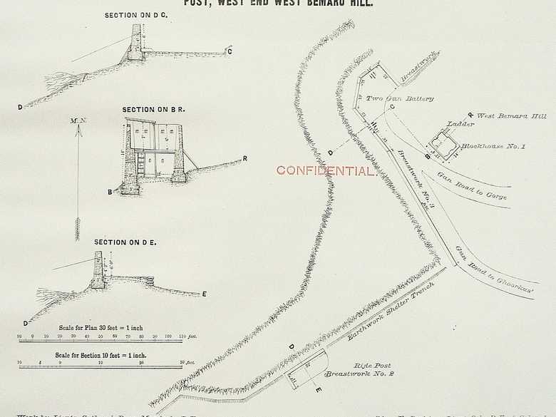
RE Plan No. 13 — Cabul Defences No. 13 Blockhouse and Rifle Post
Sections and ground plan of the military fortification at the western end of the western Bemaruh Hill, above the British cemetery, erected by the Royal Engineers under the command of Lieut.-Col. Æ. Perkins.
[Plan, recto:] Cabul Defences No. 13 / Two Gun Battery Blockhouse and Rifle / Post, West End West Bemaru Hill. // Work by Lieuts. Cather & Burn-Murdoch, R.E. / Surveyed and Drawn by Lieut. Burn-Murdoch, R.E. // (Sd). Æ. Perkins, Lieut.-Col., R.E., & Colonel / Commanding R.E., 1st & 2nd Divisions, / Northern Afghanistan Field Force. / Litho. T.C. Press, Roorkee. / No. 1419-18.
- Cabul Defences, Photo. No. –
- Collection Royal Engineers, Photo-No. RE 115-1
Image No.
RE Plan No. 13
Collection
Royal Engineers Museum, Library and Archive 1878-1880 1878-1880
Series
RE 100-115, Confidential Photographs/Plans
Format
Original drawing: 340/430 mm
Quality
Original drawing: good
Place, date
Kabul, 1880
Descriptors
Latitude / Longitude34.541834 / 69.176181
Google Earth34°32'32" N / 69°10'39" E / 1845 m
Google Mapshttps://maps.google.com
Zoom Earthhttps://zoom.earth
Survey of India MapSheet 38 (1917), Kabul: Sherpur, 2B 26
You know more about this picture?


