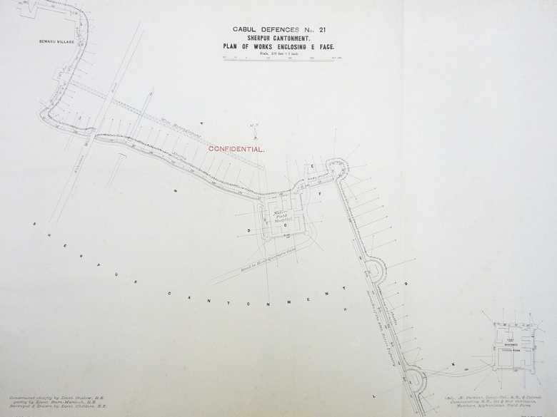
RE Plan No. 21 — Cabul Defences No. 21 Sherpur Cantonment
Ground plan of the military fortifications, erected at the eastern side of the Sherpur Cantonment by the Royal Engineers under the command of Lieut.-Col. Æ. Perkins, including the Native Field Hospital and the Fort Mahomed Hussan Khan, installed in existing Afghan Qalas.
[Plan, recto:] Cabul Defences No. 21 / Sherpur Cantonment. / Plan of Works enclosing E Face. // Constructed chiefly by Lieut. Onslow, R.E. / partly by Lieut. Burn-Murdoch, R.E. / Surveyed & Drawn by Lieut. Childers, R.E. // (Sd). Æ. Perkins, Lieut.-Col., R.E., & Colonel / Commanding R.E., 1st & 2nd Divisions, / Northern Afghanistan Field Force. / Litho. T.C. Press, Roorkee. / No. 1419-7.
- Cabul Defences, Photo. No. 25 A (= RE 115)
- Collection Royal Engineers, Photo-No. RE 077
Image No.
RE Plan No. 21
Collection
Royal Engineers Museum, Library and Archive 1878-1880 1878-1880
Series
RE 100-115, Confidential Photographs/Plans
Format
Original drawing: 510/730 mm
Quality
Original drawing: good
Place, date
Kabul, 1880
Descriptors
Latitude / Longitude34.542904 / 69.199135
Google Earth4°32'3" N / 69°12'04" E / 1800 m
Google Mapshttps://maps.google.com
Zoom Earthhttps://zoom.earth
Survey of India MapSheet 38 (1917), Kabul: Sherpur, 2B 26
You know more about this picture?


