RE 116 — British Camp at Saiyidabad
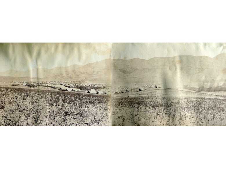
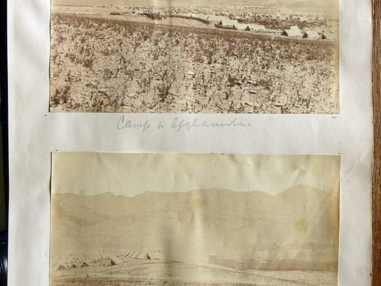
Panoramic view of a British military camp, pitched-up at Saiyidabad (half way between Kabul and Ghazni, where the Maidan and Logar Valley roads from Kabul to Ghazni join) in an undulated plain, surrounded on all sides by bare hills. On the right side of the camp a large q’ala or an Afghan fort. It was here that the ‘Screw-Guns’ (see RE 118-124) were engaged for the very first time in a battle.
Panoramic view of a British military camp, pitched-up at Saiyidabad (half way between Kabul and Ghazni, where the Maidan and Logar Valley roads from Kabul to Ghazni join) in an undulated plain, surrounded on all sides by bare hills. On the right side of the camp a large q’ala or an Afghan fort. It was here that the ‘Screw-Guns’ (see RE 118-124) were engaged for the very first time in a battle.
[Album:] Camp in Afghanistan. / Camp & walled village.
[S&M List:] 2-43/44 British Camp, General Ross’ Brigade, Saidabad.
- Original:
Private collection of Bryan Maggs, Collection BS&M, Fol. 31. - Not in the albums of the RE Collections at Chatham.
- The Second Afghan War 1878-80: Abridged Official Account (1908), p. 363: description of the camp and the events.
- Hensman, H. (1882): The Afghan War of 1879-80, p. 388: “General Ross had to clear the hills about his camp at Sydabad on two occasions prior to General Sir Donald Stewart’s force arriving from Ghazni, but there were scarcely any casualties on our side.
- Adamec, L.W. (1985): Kabul and southeast Afghanistan, p. 685: "[...] During the year 1880, Saiyidabad was used as a halting place by Sir Frederick Roberts on his march from Kabul to Kandahar. Saiyidabad was in that year a collection of scattered buildings of no importance. The best place for an encampment was then found to be on the opposite or right bank, of the Shiniz river. [...]"
- www.kipling.org.uk/rg_screwguns1.htm
Image No.
RE 116
Collection
Royal Engineers Museum, Library and Archive 1878-1880 1878-1880
Series
RE 116-140, Bryan Maggs Collection
Format
Albumen paper with gold toning, 126/188 and 128/189 mm, mounted on loose sheets of strong undulated chamois paper
Quality
faded
Place, date
Saiyidabad, mid to late April 1880
Descriptors
Latitude / Longitude34.219049 / 69.113263
Google Earth34°14' N / 69°07'E / 1930 m
Google Mapshttps://maps.google.com
Zoom Earthhttps://zoom.earth
Survey of India MapSheet 38 (1917), Kabul: Kabul, 2B 26
833 KB |

144 KB |

You know more about this picture?


