ELD 016 — Takht-e Rustam
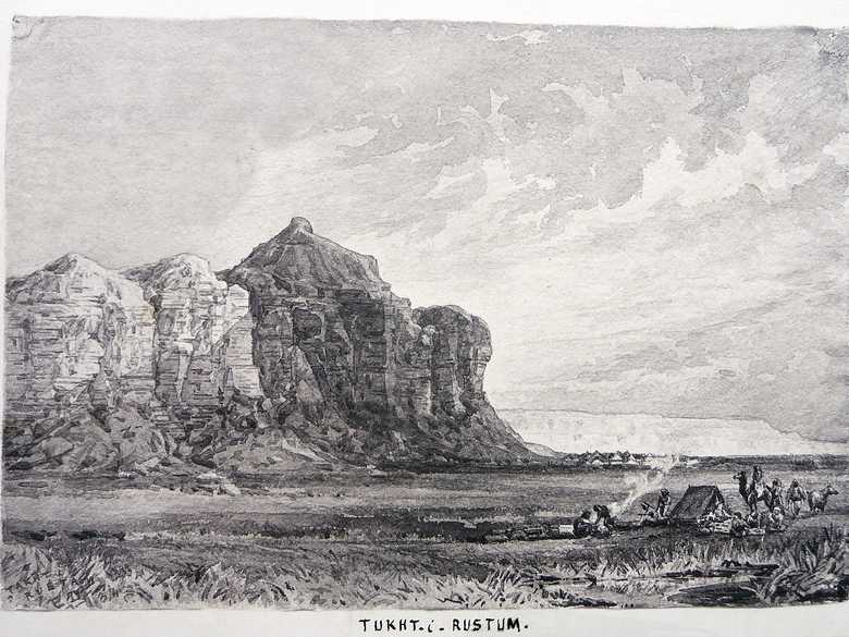
Sepia-toned photo-lithograph of a wash sketch, showing the rock formation with its perpendicular flanks at the shore of the Hamun, as seen from the NW. At its foot the camp of the ABC. In the right foreground a guard-picket.
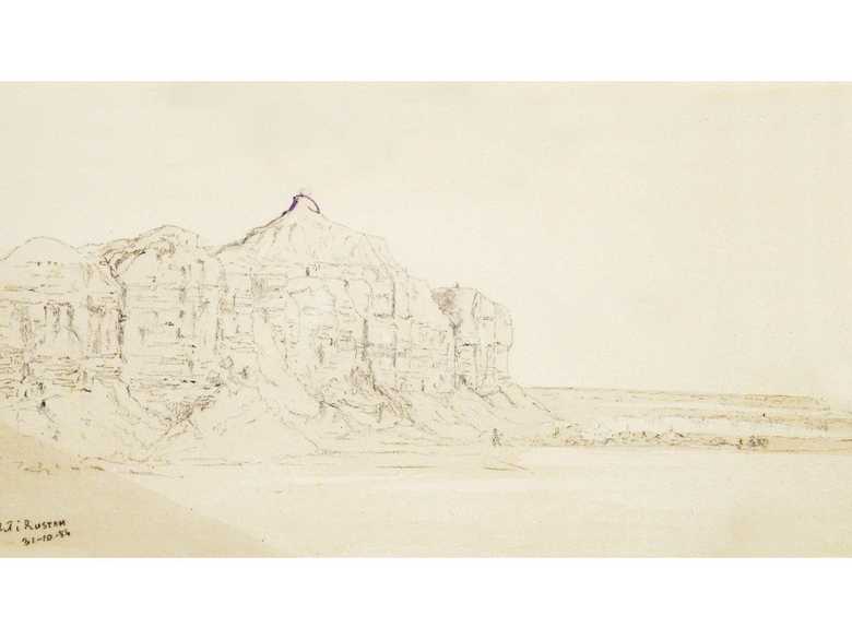
[Sketch, recto:] TAKHT I / RUSTAM / E D / 84.
[Sketch, verso:] (14) / „Rustam’s“ seat, or throne, overlooking the large lake of Seistan, “Hamum” of Lash Jowein / Nov 1st.
[Lumsden Album:] TUKHT-i-RUSTUM. // [same text as in the list]
[List:] (15) Takht i Rustam, the throne or seat of Rustam, the King Alfred of Persian History and Legend. The rock overlooks the Seistan Lakes into which the Helmund empties itself. We obtained several old Persian and Assyrian gems from the villagers about here.
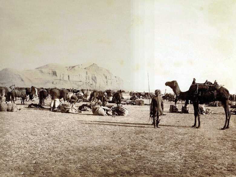
- Collection Afghan Boundary Commission, photograph ABC 012: same place.
- Owen, Charles (1884-86): Transcript of diary and letters, p. 102: “31 Oct. [1884] We marched at 5 am for Camp Takht i-Rustam, a distance [of] 17 miles. […] Takht-i-Rustam is simply a commanding part of the northern bank of the lake on which an old ruin exists. There is a carved stone nearby which no one could decipher.”
- Charles, R. (1885): Diary written when in charge of the ½ Field Hospital and Escort with the Afghan Boundary Commission, Dec. 16th, 1885, fol. 122 V – 123 R: description of the way back to India, “[…] A march of some miles over pät [alluvial clay] & between hills of pät brought us to the grassy ground at margin of Hamoon [Hamun] & under the earthy throne of Rustam on the hill. […] Today there was a very sharp keen blast (N. N.W.) blowing. Luckily we had it in our backs but it was very cold. […] This is the beginning of the Seistan wind! Though we have had wind at Anardara pass, Pousey Killata [?], Sangbur, & some at Chah Gazak. The sun shone out well in the afternoon, & we were sheltered from the blast below Rustam’s throne. Our course today was S.E. by E. Duck in myriads are on the lake but are quite safe from attack owing to the barrier of reeds.”
- Holdich, T.H. (1885): Afghan Boundary Commission; Geographical Notes, p. 164: “[…] The Takht-i-Rustam is not an imposing feature. From 200 to 300 feet above the plain it rises in a small well-defined peak from the sandstone cliffs bordering the swamp, and owes its importance in legendary history to the fact that there happens to be no other peak like it in its neighbourhood. From the Takht, however, a grand view is obtained over the lake, which in November can be seen from behind its thick and wide belt of reeds stretching away to the horizon.”
- Peacocke, W (1887): Records of Intelligence Party ABC, Vol. 3, p. 31 (Oct. 31, 1884): description of the Takht-e Rustam and the Hamun.
- Yate, A.C. (1887): Travels with the Afghan Boundary Commission, p. 97: description of the Helmund Hamun.
- Maitland, P.J. (1888): Records of Intelligence Party ABC, Vol. 1, p. 89 (Oct. 31, 1884): “At about 17 miles, the cliffs having closed in on the right, passed under a high headland for a short distance. On this is a small flat-topped knoll, which is the Takht-i-Rustam. Immediately beyond it the cliffs trend back, leaving a rather deep bay, in which was our camp, reached at 17 ¾ miles.”
- Adamec, L.W. (1973): Farah and south-western Afghanistan, p. 288: Takht-i-Rustam: “Elevation 1,680 feet. A projecting flat-headed promontory about 100 feet high, on the northeast of the eastern Hamun, 13 ½ miles southeast of Lash Juwain. It is so called from a ledge of rock supposed to have been the throne of the legendary Persian hero, Rustam. There is a fairly good and roomy camping-ground, with water from the Hamun by scooping channels in its margin.”
- Ball, W (1981): Archaeological Gazetteer of Afghanistan, p. 266: Takht-i Rustam, Seistan.
You know more about this picture?


