ELD 047 — Kush Robat
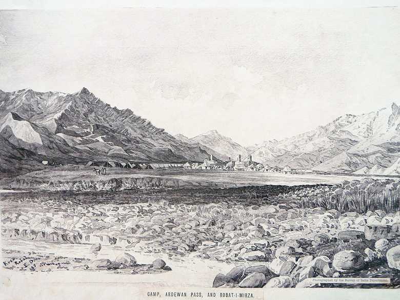
Sepia-toned photo-lithograph of a wash sketch, providing a view of the small village of Robat-e Mirza. One can behold a mosque with an eivan and a minaret, and a few pitched roof houses. In front of the village and very close to it, rows of army tents of the ABC. In the foreground a meandering stream, its banks covered with boulders.
Sepia-toned photo-lithograph of a wash sketch, providing a view of the small village of Robat-e Mirza. One can behold a mosque with an eivan and a minaret, and a few pitched roof houses. In front of the village and very close to it, rows of army tents of the ABC. In the foreground a meandering stream, its banks covered with boulders.
[Sketch, recto:] KUSH / ROBAT / E.D. / 85. // Photographed by the Survey of India Department. // CAMP, ARDEWAN PASS, AND ROBAT-I-MIRZA.
[Sketch, verso:] (39) / [detailed description of the colours of the landscape] / June 85.
[Lumsden Album:] –
[List:] (46-2) Cavalry Camp at Robati i Mirza in the Ardewan Pass.
[Sketch, verso:] (39) / [detailed description of the colours of the landscape] / June 85.
[Lumsden Album:] –
[List:] (46-2) Cavalry Camp at Robati i Mirza in the Ardewan Pass.
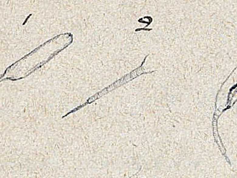
- Charles, R. (1885): Diary written when in charge of the ½ Field Hospital and Escort with the Afghan Boundary Commission, 29th June, 1885, fol. 66 R: problems at Robat-i-Mirza, “These [see sketch below] are rough sketches of a worm got in the water near Robat-i-Mirza, Ardewan Pass. 1. The water was shallow – but was a running stream. 2. Its bottom was muddy. 3. The worms were in great numbers, towards the sides, connected together by a filmy material: others swam about free. 4. 1, 2, 3, are rough sketches of it – the main part is more or less transparent – the tail is opaque & is covered by transverse striation giving it a brown hue: the tail is divided into 2 portions, a larger & a smaller shown above. 3 shows the worm under low magnifying power. The size various from ¾in to 1in long. No 1 is the size of an ordinary specimen. 5. The neighbourhood of water is a favourite grazing ground for sheep & to the water resort the nomads with flocks of sheep & goats. Excrement of these animals was everywhere manifest both in the water & on the banks.”
- Maitland, P.J. (1888): Records of Intelligence Party ABC, Vol. 1, p. 164 (Dec. 8, 1884), description of Kush Robat: “Near the debouchure of the pass is Kush Robat, a really fine, and very large, brick building, still sufficiently preserved to show the full design and details. A part, however, has fallen, and the walls of the remainder are sloping at various angles. It consists of a rectangular courtyard of considerable size, surrounded by arched cloisters in the usual fashion, and is entered by a lofty gateway on the east side. South of the main building, and attached to it, but with no communication, is a wing, or annexe, as long as the main building, but only three arches deep, and without courtyard or enclosure. This is still in good repair. It was probably intended for travellers of superior quality, or for women, and I was surprised to observe that in every recess, along both sides, were regular fireplaces with flutes. There are no windows, and the interior is gloomy to a degree, as well as dirty. However, the rows of pillared arches in the dim light somewhat reminded one of a cathedral.”
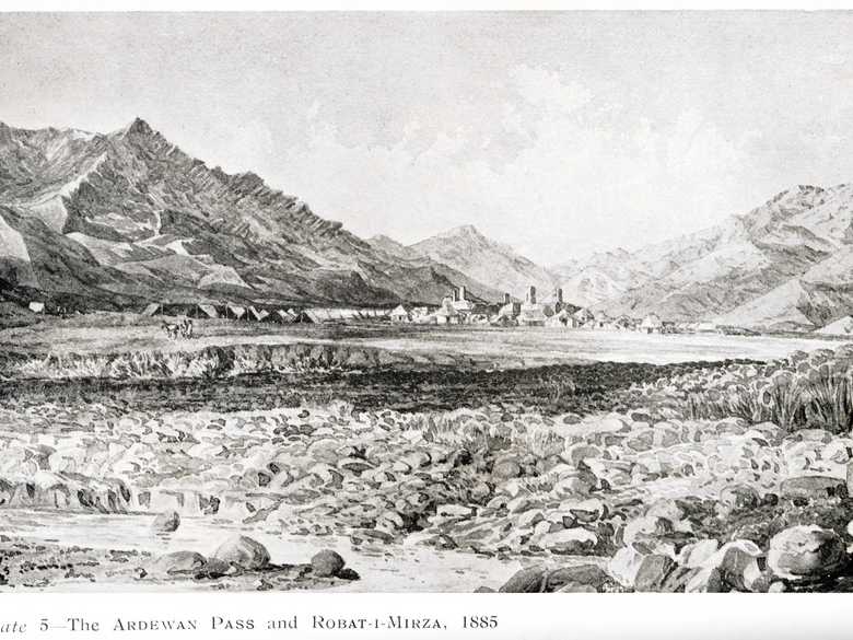
- General Staff, India (1914): Military Report on Afghanistan, “Plate 5 – The Ardewan Pass and Robat-i-Mirza, 1885.” Print of this lithograph.
- Adamec, L.W. (1975): Herat and north-western Afghanistan, pp. 286-287: Kush Robat, p. 287: “near the pass is Kush Robat, a really fine and very large brick building still in a fair state of preservation.”; p. 299: Robat-i-Mirza.
- Ball, W. (1981): Archaeological Gazetteer of Afghanistan, p. 172: Kush Rabat, “A caravan-sarai on the old route from Herat to Merv. It has a monumental gateway and a mosque facing the entrance, with vaulted rooms around all sides of the courtyard. Construction is baked brick, though in a poor state of preservation.”
Image No.
ELD 047
Collection
Afghan Boundary Commission 1884-86
Series
ABC 4, ELD Sketches 001 to 053
Format
Original wash sketch, British Library WD 430, size 230/325 mmLithograph in the Lumsden Album 222/320 mm(almost original size)
Place, date
Kush Robat, June 29, 1885
Descriptors
Latitude / Longitude34.720989 / 62.120534
Google Earth34°43ʹ10ʺ N / 62°07ʹ14ʺ E / 1480 m
Google Mapshttps://maps.google.com
Zoom Earthhttps://zoom.earth
Survey of India MapSheet 29, Herat (1916): Kush Robat, P 18
You know more about this picture?


