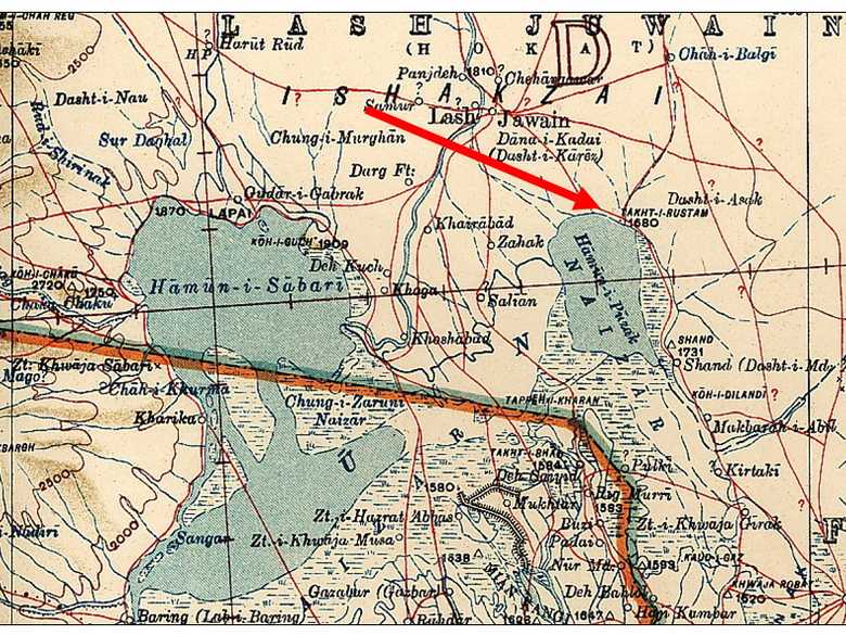
ABC 012 — Camp Takht-e Rustam
In the foreground the camel of the photographer (see ABC 013) with its Indian attendant and the picketed, unloaded horses of the ABC, most of them coverd with a blanket. In the background the faded perpendicular cliff of the Takht-e Rustam. On top of it, one person is visible.
[List:] 12. Camp Takht-i-Rustám the Hamún with the Takht in the distance.
- Collection Edward L. Durand, sketch ELD 016: same place.
- Holdich, T.H. (1885): Afghan Boundary Commission; Geographical Notes, p. 164: “[…] The Takht-i-Rustam is not an imposing feature. From 200 to 300 feet above the plain it rises in a small well-defined peak from the sandstone cliffs bordering the swamp, and owes its importance in legendary history to the fact that there happens to be no other peak like it in its neighbourhood. From the Takht, however, a grand view is obtained over the lake, which in November can be seen from behind its thick and wide belt of reeds stretching away to the horizon.”
- Yate, A.C. (1887): Travels with the Afghan Boundary Commission, p. 97: description of the Hamun.
- Adamec, L.W. (1973): Farah and south-western Afghanistan, p. 288: Takht-i-Rustam, “Elevation 1,680 feet. A projecting flat-headed promontory about 100 feet high, on the northeast of the eastern Hamun, 13 ½ miles southeast of Lash Juwain. It is so called from a ledge of rock supposed to have been the throne of the legendary Persian hero, Rustam. There is a fairly good and roomy camping-ground, with water from the Hamun by scooping channels in its margin.”
- Ball, W (1981): Archaeological Gazetteer of Afghanistan, p. 266: Takht-i Rustam, Seistan.
Image No.
ABC 012
Collection
Afghan Boundary Commission 1884-86
Series
ABC 1, Photographs 001 to 057
Format
Sepia print, 142/196 mm
Quality
good, background faded, mouldy spots
Place, date
Takht-e Rustam, November 1, 1884
Descriptors
Latitude / Longitude31.456207 / 61.829896
Google Earth31°36ʹ50ʺ N / 61°45ʹ39ʺ E / 530 m
Google Mapshttps://maps.google.com
Zoom Earthhttps://zoom.earth
Survey of India MapSheet 30, Sistan (1918): Takht-i-Rustam, D 51
You know more about this picture?


