ABC 007 — Citadel of Qala-ye Fath from Southern Side
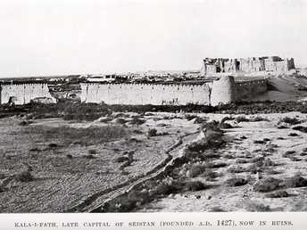
This photograph may look very much like the one taken by G.P. Tate: The Frontiers of Baluchistan, f.p. 103: a photograph of the whole Qala, taken from the south.
[List:] 7. Kala-i-Fáth; Citadel from southern side.
- Owen, Charles (1884-86): Transcript of diary and letters, pp. 98-99: “23 Oct. [1884] We marched at 5 am for Camp Killah Fultah [= Qala-ye Fath], a distance of about 23 miles. […] Killah Fultah or Killaput has a fine residence, the home of Sirdar Sharif Khan, who has settled here for the last 8 years, the land having been given him by the Amir. […] The ruined town was evidently a walled-in city with a large citadel. The latter a handsome commanding structure. On the Rudbar side of the town is a large tomb, a really handsome building only of unburnt brick. […] After mess I went to my tent and with the ruby light I took out some dry plates for photographic work.”
- Holdich, T.H. (1885): Afghan Boundary Commission; Geographical Notes, p.161: “The fort and citadel of Kala Fateh too is founded on brick, although the entire superstructure is mere mud.”; 162: “The citadel still towers high above the crumbling mud walls of the fort, and if the sarai adjoining the fort, with its central domed roof and two enormous wings, is in any proportion whatever to the former traffic of the country, it proves that there must have been a considerable amount of trade passing along this route even in comparatively recent periods, possibly long after it ceased to be the capital of the Kaiani kings. The fort walls are about two miles in circumference.”
- Peacocke, W (1887): Records of Intelligence Party ABC, Vol. 3, pp. 20-21 (Oct. 23-25, 1884): Description of Qala-ye Fath; f.p. 20: 2 sketches of the citadel and the serai.
- Yate, A.C. (1887): Travels with the Afghan Boundary Commission, pp. 83-85: the citadel is mentioned.
- Tate, G.P. (1910): Seistan, a memoir on the history, topography, ruins and people of the country, p. 246: description of the town of Kala-i-Fath; pp. 260-264: history of the city.
- Adamec, L.W. (1973): Farah and south-western Afghanistan, pp. 137-140: Kala-i-Fath; p. 137: “The extensive ruins of Kala-i-Fath are situated on the right bank of the Helmand, close to the river, about 23 ½ miles below Chahar Burjak, and are described by Ferrier as the most extensive in Sistan. […]”
- Ball, W (1981): Archaeological Gazetteer of Afghanistan, p. 206: Qal’a-i Fath. “A very large area of ruins and mounds, amongst the most extensive in Seistan. It is a square, walled city with 94 round towers up to 10 m high (in 1905), though with much of it washed away by floods. Construction is mostly mud-brick. In the northeast is a citadel quarter on a mound c. 10 m high surrounded by a double line of walls, strengthened by more round towers. The top of the mound is divided into two huge buildings, with walls a further 22 m high, with crenellations and loopholes. There are also remains of many brick kilns or ice houses up to 13 m diam., and a baked brick caravanserai or madrasa, known as the Gumbaz-i Surkh, outside the walls to the south. In the vicinity are extensive remains of gardens and canals.”
Image No.
ABC 007
Collection
Afghan Boundary Commission 1884-86
Series
ABC 1, Photographs 001 to 057
Format
Sepia print
Place, date
Qala-ye Fath, October 24 to 25, 1884
Descriptors
Latitude / Longitude30.562283 / 61.846678
Google Earth30°33ʹ43ʺ N / 61°50ʹ48ʺ E / 500 m
Google Mapshttps://maps.google.com
Zoom Earthhttps://zoom.earth
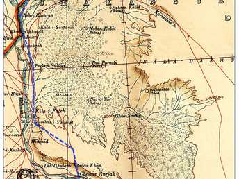
Survey of India MapSheet 30, Sistan (1918): Kilah-i-Fateh, O 58
You know more about this picture?


